









Desk Report
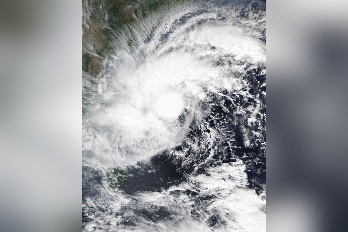
Cyclone Akvan is set to strengthen into a severe cyclonic storm on Wednesday and a very severe cyclonic storm by Thursday, crossing the Andhra Pradesh coast between Nellore and Visakhapatnam around noon on Friday, November 20, with winds gusting to 145 kmph and extremely heavy rain — the third cyclone to threaten the state in less than a month.
Where the storm stands now
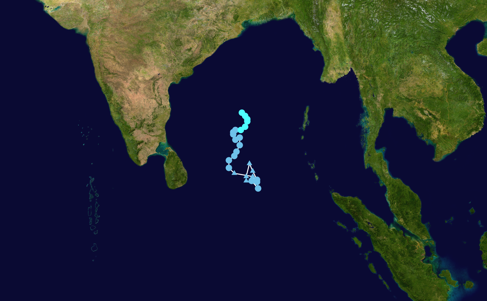
At 2:30 am IST on Wednesday, November 18, Cyclonic Storm Akvan lay centred over the central parts of the south and adjoining west-central Bay of Bengal, near latitude 12.6°N and longitude 85.6°E — about 590 km east of Chennai and 620 km south-southeast of Visakhapatnam, according to the India Meteorological Department‘s (IMD) National Bulletin No. 20 issued at 4 am. The storm has been moving slowly north-northwestwards at just about 3 kmph, and at times it has remained practically stationary — a slow drift that has repeatedly forced forecasters to revise the timeline of its intensification. At present, Akvan is packing sustained winds of 85–95 kmph, gusting to 105 kmph.
Akvan began as a low-pressure area over the southern Bay of Bengal on November 12. It became a depression on November 15 and intensified into a cyclonic storm on the evening of November 16, when its central pressure was measured at 1000 hPa and maximum sustained winds at 65 kmph, gusting to 83 kmph. The name Akvan was proposed by Iran from the WMO/ESCAP list of tropical cyclone names for the North Indian Ocean. It is the third cyclone of the 2026 North Indian Ocean season, after cyclones Arnab and Murasu, which also formed in the Bay of Bengal in the preceding weeks and battered India’s eastern seaboard.
IMD forecast: severe today, very severe by Thursday
The IMD expects Akvan to intensify into a severe cyclonic storm on Wednesday morning (November 18) and further into a very severe cyclonic storm by Thursday (November 19), as it continues to move northwestwards towards the Andhra Pradesh coast. The storm’s slow movement has already pushed the intensification timeline back once — an earlier forecast had it reaching severe status by Tuesday evening — and forecasters caution that the track may still shift. The system is then expected to cross the Andhra Pradesh and Yanam coasts around noon on Friday, November 20, as a very severe cyclonic storm.
Landfall between Nellore and Visakhapatnam on November 20
The IMD’s latest forecast puts the landfall between Nellore and Visakhapatnam, with maximum sustained wind speeds of 120–130 kmph and gusts reaching 145 kmph at the time of crossing. The corridor itself has moved during the week: earlier bulletins placed the landfall between Nellore and Tuni, but on Tuesday afternoon the IMD shifted the northern end of the stretch to Visakhapatnam, about 80 km further up the coast. At landfall, the cyclone is expected to cause extensive damage, including the uprooting of trees, damage to standing crops, power lines, electric poles, communication networks and road infrastructure. Squally winds of 40–50 kmph, gusting to 60 kmph, were already prevailing along and off the Andhra Pradesh coast and Yanam on Tuesday.
A rare third cyclone in a month for Andhra Pradesh
Akvan is the third cyclone to threaten the Andhra Pradesh coast in less than a month. IMD Director General of Meteorology Mrutyunjay Mohapatra has pointed out that it is a very rare event for a state to see three tropical cyclones cross its coast within a single month. The back-to-back systems have arrived during the ongoing northeast monsoon, which has kept the Bay of Bengal active through the post-monsoon weeks. For coastal communities that have already dealt with Arnab and Murasu, Akvan is the third test of the season’s preparedness in quick succession.
Heavy rain, red alerts and storm surge
The IMD has warned of heavy to very heavy rainfall over coastal Andhra Pradesh on November 19 and 20, with isolated extremely heavy rainfall of 21 cm or more in 24 hours. Tamil Nadu is expected to receive heavy rain on November 17–18, and south coastal Odisha will see rain building up from November 19 to 21, easing to heavy rain at isolated places over north coastal Andhra Pradesh on November 21.
A red alert for extremely heavy rainfall is in force for seven coastal districts — Kakinada, Konaseema, East Godavari, West Godavari, Eluru, Krishna and Bapatla — along with Yanam, for November 19 and 20. The Andhra Pradesh and south Odisha coasts are under a cyclone alert (orange message), the second of the IMD’s four warning stages. The IMD has also flagged a storm surge of 0.4 to 1.2 metres above the astronomical tide along parts of the Andhra coast during landfall, with seawater likely to flood low-lying areas of Prakasam, Bapatla, Krishna, West Godavari, Konaseema, Kakinada and Visakhapatnam districts, the highest risk over Bapatla, Krishna, West Godavari and Kakinada from the morning to the afternoon of November 20. The IMD’s 4:11 am coastal bulletin has also warned of squally seas and poor visibility along the coast, with warning signals hoisted at Visakhapatnam, Mulpeta, Gangavaram, Kakinada, Machilipatnam, Nizampatnam and Krishnapatnam.
Preparations along the coast
District administrations in coastal Andhra Pradesh and Odisha have been placed on alert, with the cyclone alert in force for both coasts and disaster-response machinery on standby. The IMD’s bulletins through the week have carried repeated warnings for fishermen and coastal residents, and the slow-moving storm has given the administration a longer window to prepare — even as it has made the exact landfall point harder to pin down. People in the coastal districts have been advised to follow official updates from the IMD and the district administrations rather than unverified messages circulating on social media.
What happens next
All eyes are now on the next IMD bulletins, which will confirm whether Akvan reaches severe status on Wednesday as forecast and how the landfall corridor settles. After crossing the coast around noon on Friday, the system is expected to weaken as it moves inland, though heavy rain is likely to continue over north coastal Andhra Pradesh on November 21. Until then, the forecast remains what it is — a forecast, not an event — and the track may still adjust. For the latest position and warnings, the IMD’s national bulletins and its Mausam platform remain the authoritative source.
डिस्क्लेमर: यह खबर उपलब्ध स्रोतों और सत्यापन के आधार पर तैयार की गई है। किसी तथ्य में त्रुटि होने पर सुधार प्रकाशित किया जाएगा।